- News Front Page
- Uncategorized
- Headline News
- Filipino Calgarian
- Business
- Pinoy Stories
- Community News
- Publisher's Note
- The Main Ingredient
- Views and Opinions
- Maikling Kwento
- Alberta News
- OFW – Month
- Travel News
- Health and Lifestyle
- Pinoy Toons
- Pinoy Spirit
- Entertainment
- The Philippine Lawyer
- Horoscope
- Greetings
- About Us
- Greetings From the Prime Minister
- Greetings from the President of the Philippines
- Greetings from the Premier of Alberta
- Greetings from the Mayor of Calgary
- Advertise With Us
- Disclaimer
- Subscription
Publisher's Note
- Publisher’s Note
Email a copy of 'Publisher's Note' to a friend
 Loading ...
Visitors to Pinoytimes
Page added on May 23, 2018
Corregidor…The Rock
by C.K.
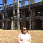
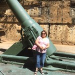
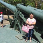
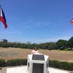
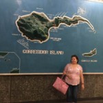
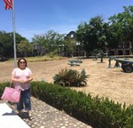
On my recent visit to the Philippines, I decided to take the day tour to Corregidor. For the longest time, I remember this as past of our Philippine History in high school. I really did not have a clue to which province this island belong. So I did my research from my friendly Wikipedia to share some information you might want to know before you go on the Corregidor day tour. The guide we had was very knowledgeable but I did not have my pen and paper to write everything about what she said. All I know that it was very hot that day and all the ruins from the war is such a view to see.
Corregidor Island, locally called Isla ng Corregidor, is an island located at the entrance of Manila Bay in southwestern part of Luzon Island in the Philippines. Due to this location, Corregidor has historically been fortified with coastal artillery to defend the entrance of Manila Bay and Manila from attacks by enemy warships. Located 48 kilometres (30 mi) inland, Manila has been the largest city and the most important seaport in the Philippines for centuries, from the colonial rule of Spain, Japan and the United States, to the establishment of the Philippines in 1946.
Corregidor (Fort Mills) is the largest of the islands that formed the harbor defenses of Manila Bay, together with El Fraile Island (Fort Drum), Caballo Island (Fort Hughes) and Carabao Island (Fort Frank), which were all fortified during the American colonial period. The island was also the site of a small military airfield, as part of the defense.
During World War II, Corregidor played an important role during the invasion and liberation of the Philippines from Japanese forces. The island was heavily bombarded during the latter part of the war, and the ruins serve as a military memorial to American, Filipino and Japanese soldiers who served or lost their lives on the battlefield. Corregidor is one of the important historic and tourist sites in the country.
Topside
The island’s biggest area, which points towards the West Philippine Sea, rises prominently to a large flat area that is called “Topside”. Beneath this was the fortified communications center of the island, as well as the location for the Army headquarters, barracks for enlisted men, a branch of the Philippine Trust Co. bank, the Cine Corregidor movie theater, officers’ quarters, underground ordnance shops, the parade ground, an Officers’ Club with a 9-hole Golf Course, tennis courts, and swimming pool, and the bulk of the artillery batteries that constituted the strength of Corregidor.
Middleside
Middleside is a small plateau that interrupts the upward slope from Bottomside to Topside, and was the location of 2-story officers’ quarters, barracks for the enlisted men, a hospital, quarters for non-commissioned officers, a service club, PX, and two schoolhouses—one for the children of Filipino soldiers and the other for American children.
Bottomside in 1982
Bottomside is the lower part of the island and is the neck that connects the tail and head of the island. South of Bottomside was Barangay or Barrio San José (near what was Navy Beach); on the north is what was Army Dock, with its three large piers, and, east of Bottomside, is the Malinta Tunnel. The Malinta Hill separates Bottomside from the Tail End.
Tailside
The Tailside or Tail End is not a given name, but it is the remaining portion of the island where different memorials, shrines and the island’s airstrip are located. Kindley Field was constructed in the early 1920s and named in honor of an early hero of the U.S. Army Air Corps. The airfield was operated then by the army, and the navy had a seaplane base. The short runway, cramped and hilly terrain had limited its use.
Source: Wikipedia
see gallery_shortcode() in wp-includes/media.phpFEATURES, VIEWS & REVIEWS

The Main Ingredient
Ingredients to satisfy most of our tastebuds
Views & Opinions
Different views and opinions

Maikling Kuwento Atbp
Short stories from our contributors
LATEST HEADLINES
- GLOBALFEST 2018
- ISKWELAHANG PILIPINO (IP) RONDALLA OF BOSTON WINS THE HEARTS OF CALGARIANS
- Pinay doctor joins Medicus Family Clinic and Pharmacy
- Multicultural Ethnic Media round table with Minister of Finance Joe Ceci together with Minister of Social Services Irfan Sabir
- Trans Mountain Pipeline keeps Canada working
COMMUNITY NEWS
 PHILIPPINE CULTURAL PAVILION AND FOOD BOOTH AT THE GLOBALFEST 2018
 A new way forward for some immigration application processing times
 Calgary Stampede 2018 Poster
 Alberta celebrates first Philippine Heritage Month
PINOY STORIES
 DOTr, LTFRB launch modern buses in metro
- Holy Week practices in the Philippines
PINOY SPIRIT
HAVE YOUR SAY
Lorem ipsum dolor sit amet, consectetur adipiscing elit, dolor sit ipsum.PROMOTIONAL BLOCK
Lorem ipsum dolor sit amet, consectetur adipiscing elit, dolor sit ipsum.TRAVEL NEWS
PINOY TOONS
Tags
Archives


